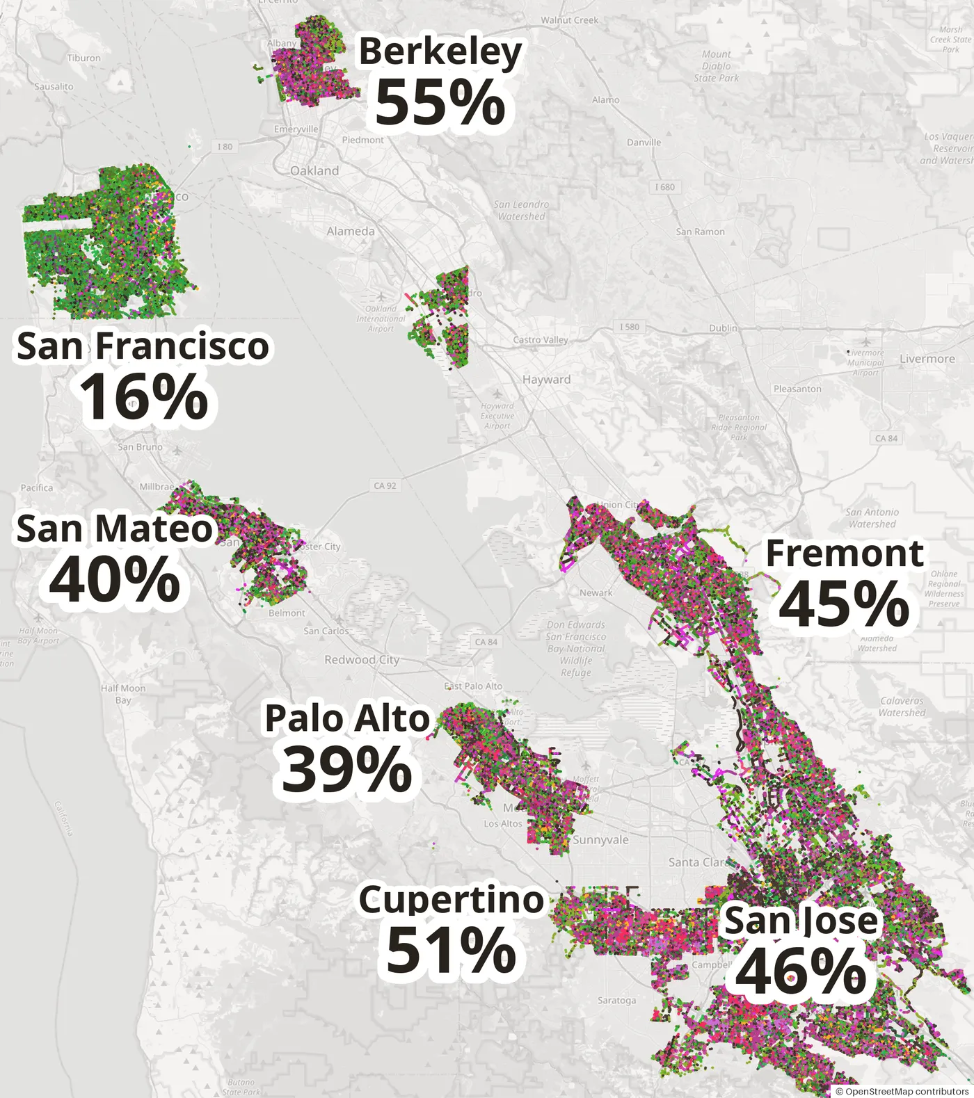
Short answer: look on city streets, not in the hills. Go to Berkeley and the South Bay rather than San Francisco: 55% of Berkeley's street trees and 51% of Cupertino's change color in autumn, against 16% in San Francisco. Most peak from mid-November to early December.
The color is in the cities, not the hills
Many roundups send you to the hills: Secret San Francisco's list[1] starts with Mt. Tamalpais and Rancho San Antonio, while admitting Mt. Tam's oaks and bay laurels "aren't known for their brilliant color change". That is the problem: the native woodland is evergreen. Coast live oak[2], bay laurel[3], redwood and madrone keep their leaves; only bigleaf maple[4] in creek canyons and poison oak[5] add patches of yellow and red, and buckeye[6] is bare by summer's end. California Fall Color's John Poimiroo puts it plainly: "in coastal California, there is minimal natural fall color"[7].
The color in Bay Area autumn photos is planted — Chinese pistache, sweetgum, maples and ginkgo along city streets. Even in Mountain View, "landscaped trees provide the dominant fall color"[8]. So it can be counted: of 646,664 trees in the cities' street-tree inventories, 259,072 (40%) turn red, purple or yellow, and every one is on the TreeColors map.
Same bay, three times the color
A tree turns when its leaves change color before falling. On the map, red-to-purple dots turn, orange dots are ginkgo, and green dots are evergreens that stay green all winter.
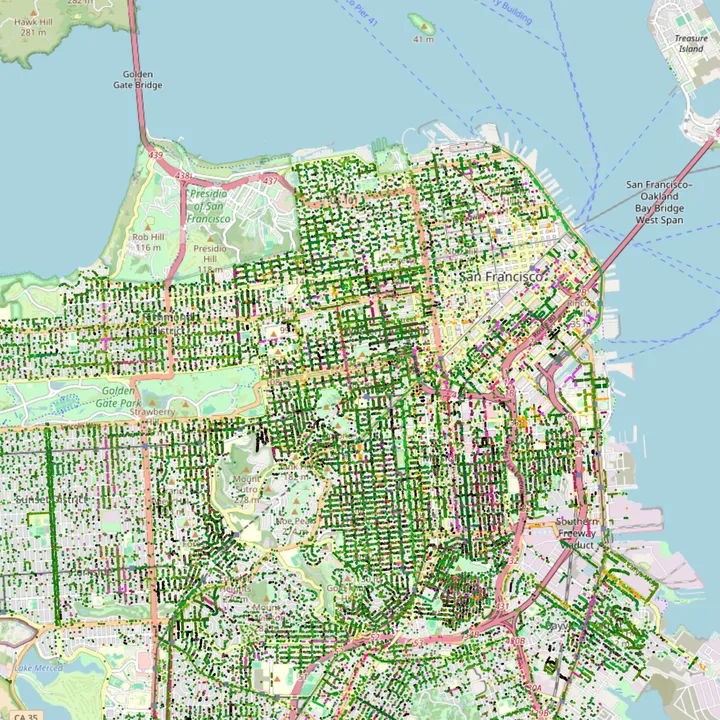
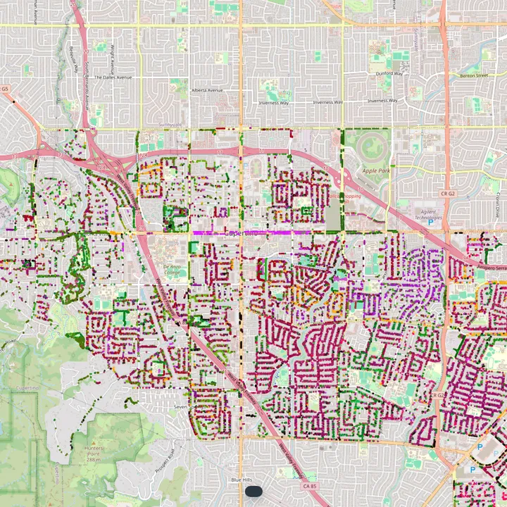
The difference is not the climate; it is what each city planted. In San Francisco, evergreens such as sweet pittosporum, southern magnolia and marina madrone line whole streets. The inland suburbs planted Chinese pistache, sweetgum and crape myrtle instead.
Bay Area cities ranked by fall color
| City | Street trees | Turn in autumn | Share |
|---|---|---|---|
| Berkeley | 30,316 | 16,527 | 55% |
| Cupertino | 16,584 | 8,422 | 51% |
| Milpitas | 17,240 | 8,445 | 49% |
| Mountain View | 28,518 | 13,196 | 46% |
| San Jose | 204,593 | 93,635 | 46% |
| Fremont | 78,237 | 35,566 | 45% |
| Los Gatos | 11,993 | 5,451 | 45% |
| Concord | 75,611 | 31,028 | 41% |
| San Mateo | 22,950 | 9,069 | 40% |
| Palo Alto | 30,258 | 11,873 | 39% |
| Burlingame | 16,433 | 6,331 | 39% |
| San Leandro | 14,230 | 4,205 | 30% |
| San Francisco | 95,051 | 14,986 | 16% |
Cities with fewer than 5,000 inventoried trees are left out. Some inventories cover only part of a city's trees, so treat small differences as noise.
Where to go, tree by tree
Even in a colorful city, each tree clusters on particular streets. For the four trees most worth a trip, these are the densest patches in the inventories, at most one per city. Each snapshot is the TreeColors map with that tree selected, about half a mile across: bright dots are that tree, faint dots are everything else. Tap a snapshot to open the spot in Google Maps.
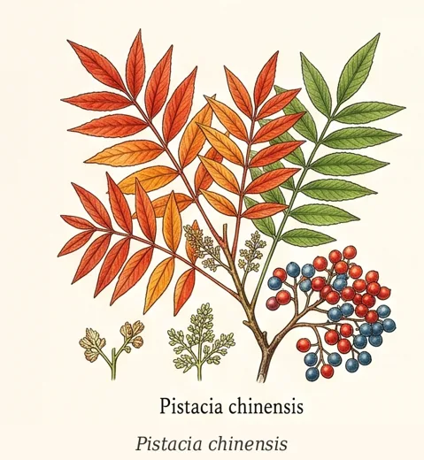
Chinese pistache
Pistacia chinensis · 41,539 on Bay Area streets · Mid-November to early December
The brightest street tree in the Bay Area: scarlet to orange, often three colors on one tree.
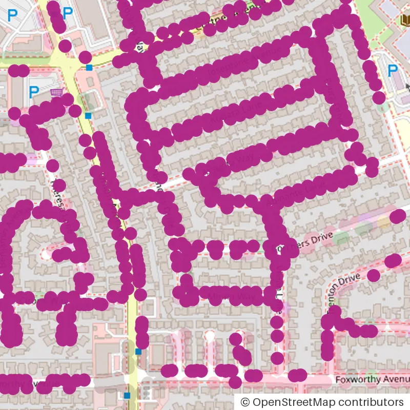
Dry Creek, around Abinante Lane
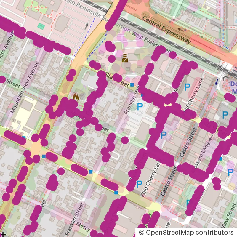
around Franklin Street
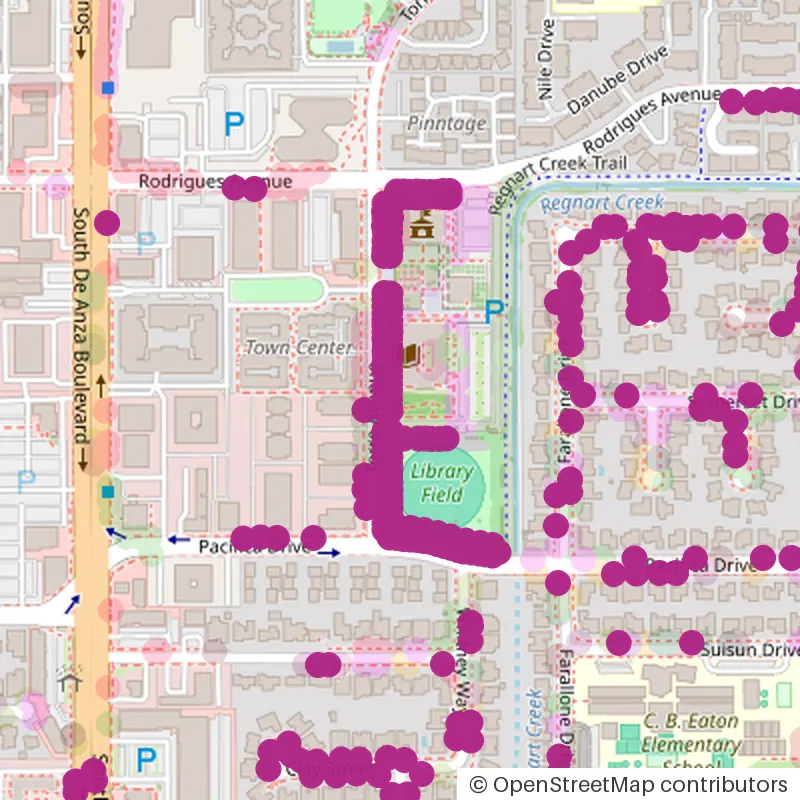
around Torre Avenue
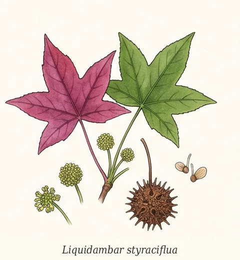
Sweetgum
Liquidambar styraciflua · 34,081 on Bay Area streets · Late November to mid-December
Star-shaped leaves in wine red and purple. The last to finish.
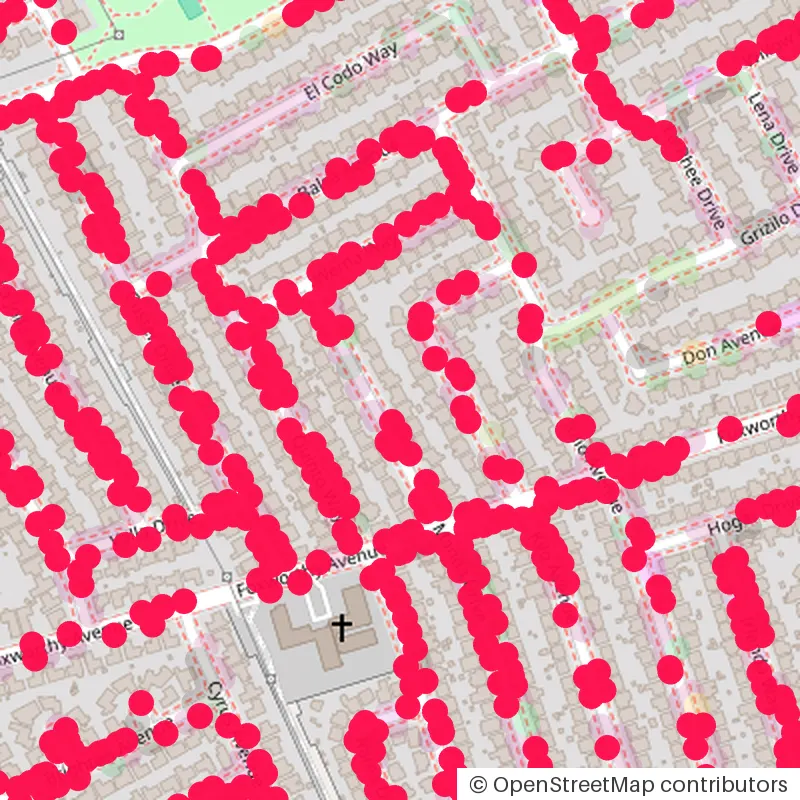
Dry Creek, around Manda Drive
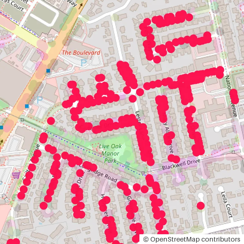
Vasona Junction, around Carlester Drive
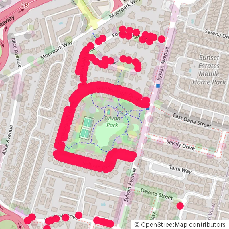
around Glenborough Drive
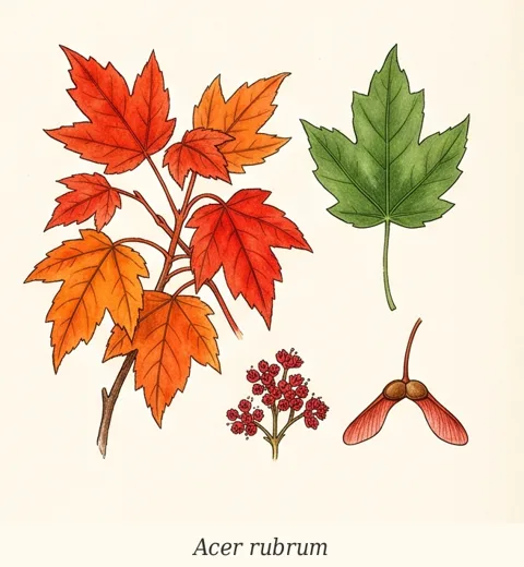
Maples
Acer rubrum, A. palmatum and others · 22,792 on Bay Area streets · Mid-November to early December
Red maple is the common street maple here; Japanese maples are mostly in gardens. Fewer than pistache, but the cleanest reds.
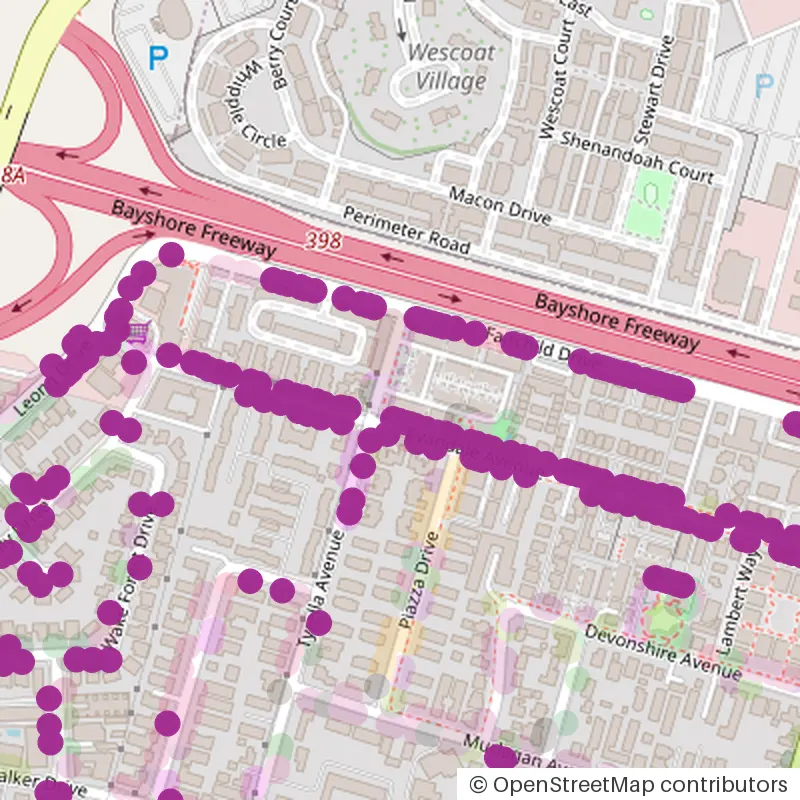
around Sonoma Terrace
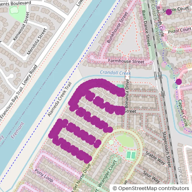
around Pack Horse Street
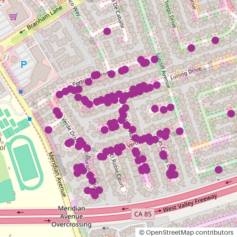
around La Paz Court
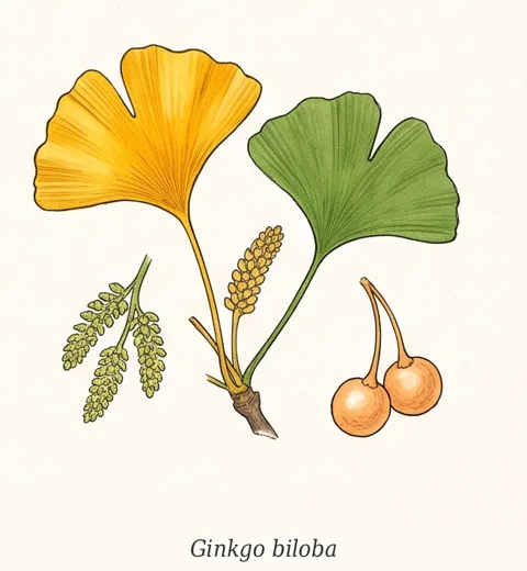
Ginkgo
Ginkgo biloba · 14,045 on Bay Area streets · Late November
One clean butter yellow. A row of ginkgos turns in the same week, then drops within days.
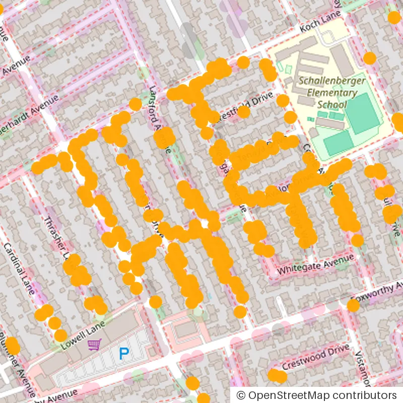
Dry Creek, around Lansford Avenue
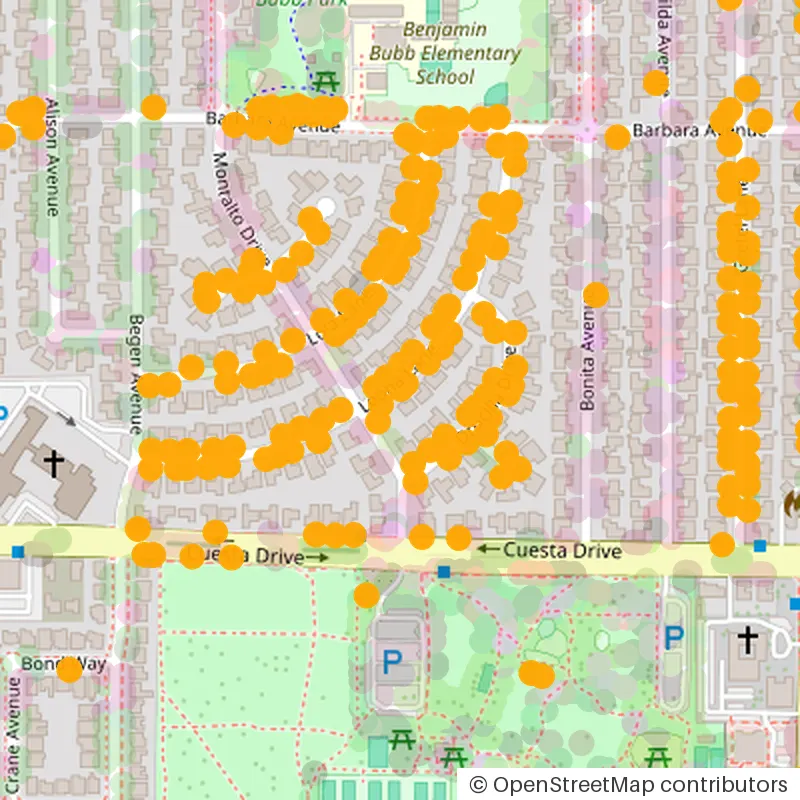
around Leona Lane
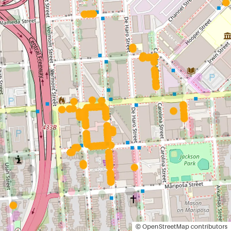
Potrero Hill, around Rhode Island Street
Crape myrtle is on nearly every street too, but it colors first — orange and red from late October — and by mid-November most are bare, so it is left out of the snapshots.
Where you won't find much
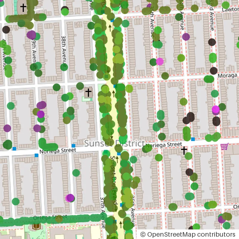
- San Francisco's west side. Well planted, but with evergreens: in this snapshot, 17 of 842 street trees turn. Green dots stay green all winter.
- The hills and open space preserves. Mostly evergreen oak, bay and redwood; see above.
When to go
- Late October to mid-November: crape myrtle and the first pistaches, inland first — San Jose, Fremont, Concord. By mid-November many crape myrtles are already bare.
- Mid-November to early December: the peak. Pistache, maples, ginkgo and ornamental pears across the South Bay, the Peninsula and the East Bay.
- December: sweetgum holds the longest, often into mid-December; San Francisco's few deciduous streets turn late too.
Last year's reports fit this pattern: California Fall Color spotters found Los Altos pistaches near peak on 9 November 2025[9], and Sunnyvale and Mountain View streets still at peak on 5–7 December[10].
Find a street near you
Open the map and zoom in on your neighborhood. Follow the red and purple dots, skip the green ones. Tap any tree for its species, a botanical illustration, photos and the city's own inventory record.
The same map works beyond the Bay Area: Vancouver (79% of 150,114 street trees turn, peak mid-October to early November), Los Angeles (26%, December) and San Diego, plus 39 cities across the US and Canada in all.
FAQ
When is peak fall color in the Bay Area?
Mid-November to early December for most street trees. Crape myrtle colors first, from late October, and is mostly bare by late November; sweetgum is last and often holds into mid-December.
Are there fall colors in the Bay Area hills?
Very little. The native hill woodland is mostly evergreen: coast live oak, California bay laurel, redwood, Douglas fir and madrone. Bigleaf maple turns yellow in shaded creek canyons and poison oak turns red, but the big displays are planted street trees in the cities.
Where is the best fall color near San Francisco?
Inside San Francisco the color is scattered: only 16% of its street trees turn. The densest street-tree color is in Berkeley (55%) and the South Bay — Cupertino (51%) and San Jose (46%).
Which Bay Area street trees turn red?
Chinese pistache, sweetgum, red maple, Japanese maple and crape myrtle. Ginkgo turns yellow.
Does the fall color map cover other cities?
Yes. The same map covers 39 cities in the US and Canada, including Vancouver (79% of street trees turn), Los Angeles (26%) and San Diego (16%).
Is the map free?
Yes. It runs in the browser, with no account and nothing to install.
Who made this guide and the map?
BotaniSense. We use AI and open data to bring plants closer to everyday life: what is growing around you, how to look after it, and where and when to go see it. Our main product is the free, ad-free BotaniSense app for iPhone and Android, which gathers the plant photos in your camera roll, identifies them and keeps a care diary. The fall color map is one of our free web tools, built from 39 cities' public street-tree inventories; every number in this guide comes from it. About the BotaniSense app →
Sources
- [1] Secret San Francisco, updated 29 Nov 2024. 12 Bay Area Spots To See Fall Colors At Their Peak This Season
- [2] Wikipedia. Quercus agrifolia (coast live oak)
- [3] Wikipedia. Umbellularia (California bay laurel)
- [4] Wikipedia. Acer macrophyllum (bigleaf maple)
- [5] Wikipedia. Toxicodendron diversilobum (Pacific poison oak)
- [6] Wikipedia. Aesculus californica (California buckeye)
- [7] SFGATE, 2 Oct 2021. Where to find the prettiest fall foliage in Northern California and Bay Area
- [8] California Fall Color, 19 Nov 2022. Bay Area Beauty
- [9] California Fall Color, 11 Nov 2025. Bay Area Color Builds
- [10] California Fall Color, 12 Dec 2025. Fall Marches On In Bay Area and Beyond